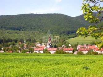
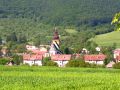
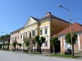
With no doubt, the town Štítnik is the most interesting town in the Gemer region. It arose in the 13-th century as a settlement of miners. In 1328 it was awarded a Krupina right. Important metallurgical enterprises employed many craftsmen in this area. Štítnik was an important trading center as well. At the periphery there was a water castle from the 15-century, from which only ruins were preserved. Many houses of important local citizens and craftsmen kept its original classicistic appearance.
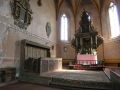
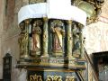
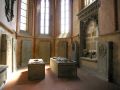
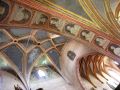
The most important historical monument in the town is a gothic Protestant church which was declared a protected National cultural monument. Originally it was a basilica of 3 naves with beautiful stellate arches. Walls are painted on the area of more than 200 m2 by secco and fresco wall paintings dated to the 14-th and 15-th century representing different religious scenes. Some of the interior objects are still very well preserved - such as a bronze baptistery from the 15-th century, church benches from the 16-18-th century, the main renaissance-baroque altar from the year 1636, a pulpit from the year 1693 and a lot of small works of arts.
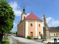
A Roman-Catholic church was built in the 18-th century and has baroque equipment. In front of the church there is a commemorative column of plague from the year 1710.
Štítnik is a suitable starting point for the hikes to Plešivecká Plain (Plešivecká planina), which is a part of the National Park Slovak Karst (Slovenský kras). A tourist trail is heading to Gerlašské Rocks (Gerlašské skaly) where you can enjoy a breathtaking view of surroundings.