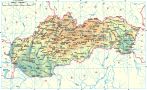
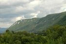
The Slovak Karst is situated on the Slovak - Hungarian border, surrounded by South-Slovak Lowland, Rožňavská and Košická Basin and Volovské Hills. It is the largest karst area in Slovakia. From 3610 km2 of its area 3490 km2 are protected. It is divided into 7 plains: Koniarska Plain, Plešivská Plain, Silická Plain, Horný Vrch (Upper Hill), Zádielska Plain, Jasovská Plain and Dolný vrch (Lower Hill). Jepšavský Karst is situated on the western end of the Slovak Karst.
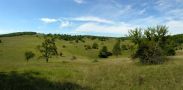
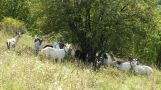
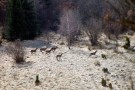
The Slovak Karst consists of dolomites and limestone, in the south almost 400-500 m thick, full of deep canyons created by the rivers Slaná and Štítnik as well as by the Zádielsky and Hájsky Creek. The plains are full of numerous caves and abysses. You can even find here thermophilic flora with endemic features, which is more typical for heath and forest-heath regions.
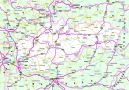
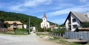
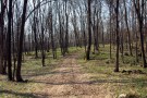
The paths leading to Domica Cave, Jasovská Cave, Gombasecká Cave, Silická ľadnica abyss and to other wonderful places in this area are marked. The most suitable starting points are: Rožňava, Jasov, Zádielske Dvorníky, Silica, Kečovo, Plešivec, Štítnik and Turnianske Podhradie.